
Thank you for supporting this site ❤️
Make a donation
Make a donation
Gear up for your next adventure:
As an Amazon Associate, this site earns from qualifying purchases at no extra cost to you.
Kneiff topographic map
Click on the map to display elevation.
Thank you for supporting this site ❤️
Make a donation
Make a donation
Gear up for your next adventure:
As an Amazon Associate, this site earns from qualifying purchases at no extra cost to you.
About this map
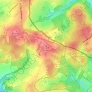
Name: Kneiff topographic map, elevation, terrain.
Location: Kneiff, Troisvierges, Canton Clervaux, 9999, Luxembourg (50.15768 6.03704 50.15778 6.03714)
Average elevation: 1,719 ft
Minimum elevation: 1,545 ft
Maximum elevation: 1,841 ft
Thank you for supporting this site ❤️
Make a donation
Make a donation
Gear up for your next adventure:
As an Amazon Associate, this site earns from qualifying purchases at no extra cost to you.