
Thank you for supporting this site ❤️
Make a donation
Make a donation
Gear up for your next adventure:
As an Amazon Associate, this site earns from qualifying purchases at no extra cost to you.
Ollignies topographic map
Click on the map to display elevation.
Thank you for supporting this site ❤️
Make a donation
Make a donation
Gear up for your next adventure:
As an Amazon Associate, this site earns from qualifying purchases at no extra cost to you.
About this map
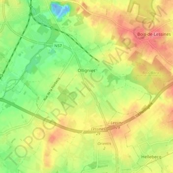
Name: Ollignies topographic map, elevation, terrain.
Location: Ollignies, Lessines, Ath, Hainaut, Wallonie, 7866, Belgique (50.66940 3.83063 50.69650 3.90619)
Average elevation: 128 ft
Minimum elevation: -82 ft
Maximum elevation: 249 ft
Thank you for supporting this site ❤️
Make a donation
Make a donation
Gear up for your next adventure:
As an Amazon Associate, this site earns from qualifying purchases at no extra cost to you.