Geolocate

Gubadli topographic map

Click on the map to display elevation.

About this map
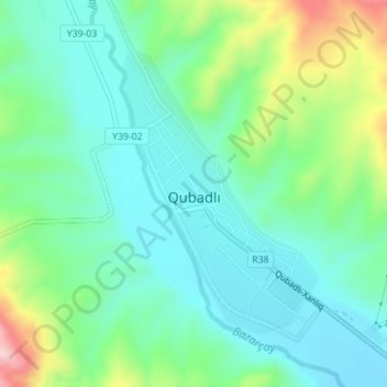
Name: Gubadli topographic map, elevation, terrain.

Location: Gubadli, Qubadli District, Azerbaijan (39.33396 46.57452 39.35371 46.59227)

Average elevation: 1,755 ft

Minimum elevation: 1,526 ft

Maximum elevation: 2,379 ft

Gear up for your next adventure:

🔥Camping Stove - Portable stove for camping and backcountry cooking
🔦Compact Flashlight - Reliable flashlight for emergencies
🚁Photography Drones - Capture stunning aerial views of landforms and topography
💧Water Filtration Bottles - Safely drink from streams and lakes while exploring
🔭Compact Binoculars - HD vision for scouting terrain and identifying distant landmarks

As an Amazon Associate, this site earns from qualifying purchases at no extra cost to you.