Geolocate

Pupukea topographic map

Click on the map to display elevation.

About this map

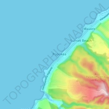
Name: Pupukea topographic map, elevation, terrain.

Location: Pupukea, Waiale‘e, Honolulu County, Hawaii, United States (21.63292 -158.07695 21.69487 -158.01832)

Average elevation: 167 ft

Minimum elevation: 0 ft

Maximum elevation: 1,010 ft

Honolulu County trails, hiking, mountain biking, running and outdoor activities

Gear up for your next adventure:

🥾Hiking Shoes - Durable and comfortable shoes for trail hiking
🔭Telescopic Hiking Pole - Adjustable pole for hiking stability
🌧️Backpack Rain Cover - Keep gear dry in wet weather
🚑Emergency Bivvies - Heat-reflective sleeping bags for survival situations
🏕️Tent Footprint - Protect your tent base from wear

As an Amazon Associate, this site earns from qualifying purchases at no extra cost to you.