
Republic topographic map
Click on the map to display elevation.
About this map
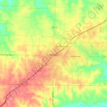
Name: Republic topographic map, elevation, terrain.
Location: Republic, Greene County, Missouri, 65738, United States (37.08021 -93.52070 37.16021 -93.44070)
Average elevation: 1,270 ft
Minimum elevation: 1,129 ft
Maximum elevation: 1,381 ft
Greene County trails, hiking, mountain biking, running and outdoor activities