
Pampas topographic map
Interactive map
Click on the map to display elevation.
About this map
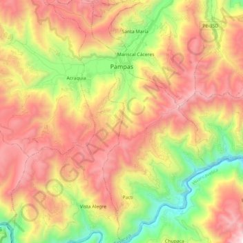
Name: Pampas topographic map, elevation, terrain.
Location: Pampas, Provincia de Tayacaja, Huancavelica, Perú (-12.52371 -74.89047 -12.35181 -74.80288)
Average elevation: 12,185 ft
Minimum elevation: 8,832 ft
Maximum elevation: 15,499 ft
Other topographic maps
Click on a map to view its topography, its elevation and its terrain.
Pampas
Perú > Huancavelica > Pampas > Pampas
Pampas, Provincia de Tayacaja, Huancavelica, 09000, Perú
Average elevation: 12,018 ft