Geolocate

Havelock topographic map

Click on the map to display elevation.

About this map

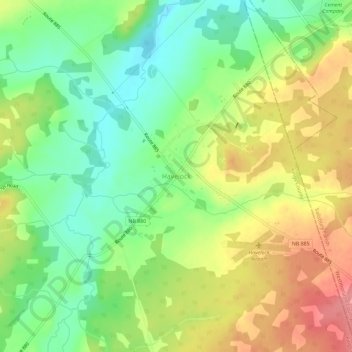
Name: Havelock topographic map, elevation, terrain.

Location: Havelock, Havelock Parish, Butternut Valley Rural Community, Kings County, New Brunswick, Canada (45.97447 -65.33579 46.01447 -65.29579)

Average elevation: 305 ft

Minimum elevation: 171 ft

Maximum elevation: 472 ft

Gear up for your next adventure:

🔌USB Car Charger - Car charger for on‑the‑go power needs
🧭Pro Hiking Compasses - High-accuracy liquid-filled compasses for topographic orientation
🥘Titanium Cookware - Durable, featherlight pots and pans for backpacking
🌄Hiking Binoculars - Compact binoculars for scenic views and trail spotting
⛑️Personal Locator Beacon - Safety beacon for emergencies

As an Amazon Associate, this site earns from qualifying purchases at no extra cost to you.