
Make a donation
Gear up for your next adventure:
As an Amazon Associate, this site earns from qualifying purchases at no extra cost to you.
Karlovy Vary topographic map
Click on the map to display elevation.
Make a donation
Gear up for your next adventure:
As an Amazon Associate, this site earns from qualifying purchases at no extra cost to you.
About this map
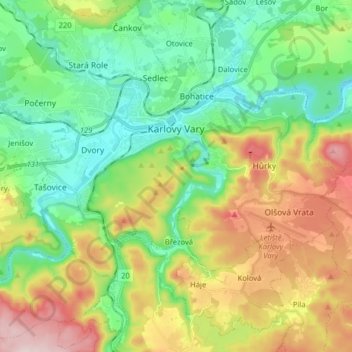
Name: Karlovy Vary topographic map, elevation, terrain.
Average elevation: 1,604 ft
Minimum elevation: 1,184 ft
Maximum elevation: 2,375 ft
Make a donation
Gear up for your next adventure:
As an Amazon Associate, this site earns from qualifying purchases at no extra cost to you.
Other topographic maps
Click on a map to view its topography, its elevation and its terrain.
Klínovec
Czechia > Northwest > Karlovy Vary Region > Jáchymov
Klínovec (German: Keilberg) is the highest peak of the Ore Mountains, located in the Czech Republic's part of the mountains at 1,244 metres (4,081 ft). There is an 80 m TV broadcasting tower on the top of the mountain and a 24 meter high lookout tower. From the south side, the Jáchymov - Klínovec chairlift…
Average elevation: 3,550 ft