Geolocate

Pembrook topographic map

Click on the map to display elevation.

About this map

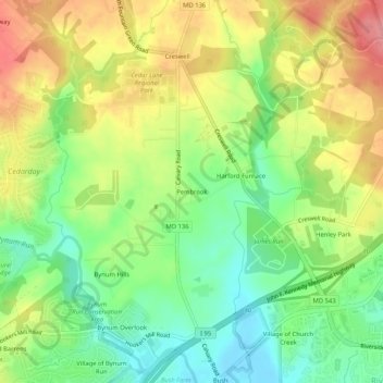
Name: Pembrook topographic map, elevation, terrain.

Location: Pembrook, Harford County, Maryland, 21017, United States (39.47344 -76.28801 39.51344 -76.24801)

Average elevation: 154 ft

Minimum elevation: 7 ft

Maximum elevation: 331 ft

Harford County trails, hiking, mountain biking, running and outdoor activities

Gear up for your next adventure:

🪵Folding Camp Saw - Compact saw for wood and campsite work
🥤Water Filter Bottle - All‑in‑one filter bottle for safe hydration
🔥Fast-Boil Camping Stoves - Efficient cooking systems for quick trail meals
🩳Quick‑Dry Hiking Shorts - Comfortable and quick‑dry shorts for summer hiking
🎒Outdoor Daypacks - Lightweight backpacks designed for carrying maps and essential gear

As an Amazon Associate, this site earns from qualifying purchases at no extra cost to you.