
Hammamet topographic map
Interactive map
Click on the map to display elevation.
About this map
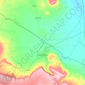
Name: Hammamet topographic map, elevation, terrain.
Location: Hammamet, daïra Bir Mokadem, Tébessa, Algérie (35.40267 7.83938 35.54675 8.05183)
Average elevation: 3,051 ft
Minimum elevation: 2,441 ft
Maximum elevation: 4,459 ft
Other topographic maps
Click on a map to view its topography, its elevation and its terrain.
Bir Mokkadem
Algérie > Tébessa > daïra Bir Mokadem > Bir Mokkadem
Bir Mokkadem, daïra Bir Mokadem, Tébessa, Algérie
Average elevation: 3,750 ft