Geolocate

Lenexa topographic map

Click on the map to display elevation.

About this map

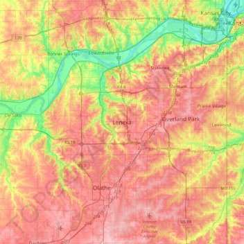
Name: Lenexa topographic map, elevation, terrain.

Location: Lenexa, Johnson County, Kansas, 66219, United States (38.80975 -94.94458 39.12975 -94.62458)

Average elevation: 951 ft

Minimum elevation: 722 ft

Maximum elevation: 1,119 ft

Johnson County trails, hiking, mountain biking, running and outdoor activities

Other topographic maps

Click on a map to view its topography, its elevation and its terrain.

Gear up for your next adventure:

🎒Outdoor Daypacks - Lightweight backpacks designed for carrying maps and essential gear
🏕️Family Camping Gear - Essentials for group camping trips
💧Water Purification System - Clean water on the trail with reliable purifiers
🦺Reflective Outdoor Gear - Safety gear for low‑light conditions
📚USA Hiking Guide Books - Top trail guides and map books

As an Amazon Associate, this site earns from qualifying purchases at no extra cost to you.