
Raymond topographic map
Click on the map to display elevation.
About this map
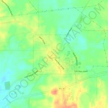
Name: Raymond topographic map, elevation, terrain.
Location: Raymond, Hinds County, Mississippi, United States (32.24993 -90.43177 32.27119 -90.38466)
Average elevation: 289 ft
Minimum elevation: 220 ft
Maximum elevation: 381 ft
Hinds County trails, hiking, mountain biking, running and outdoor activities