Geolocate

Covedale topographic map

Click on the map to display elevation.

About this map

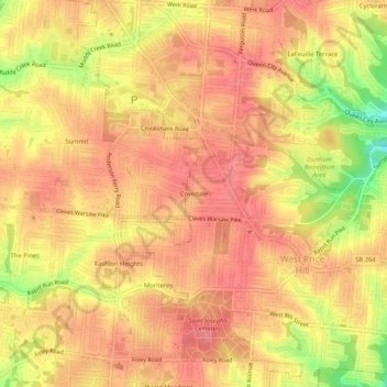
Name: Covedale topographic map, elevation, terrain.

Location: Covedale, Cincinnati, Hamilton County, Ohio, 45238, United States (39.10117 -84.62633 39.14117 -84.58633)

Average elevation: 866 ft

Minimum elevation: 692 ft

Maximum elevation: 935 ft

Gear up for your next adventure:

🎒Day Hiking Backpack - Lightweight backpack perfect for day trips and outdoor adventures
💧Water Filtration Bottles - Safely drink from streams and lakes while exploring
🏕️Tent Footprint - Protect your tent base from wear
🌄Hiking Binoculars - Compact binoculars for scenic views and trail spotting
🪓Survival Multi‑Tool - Versatile tool for camp and trail tasks

As an Amazon Associate, this site earns from qualifying purchases at no extra cost to you.