
Thank you for supporting this site ❤️
Make a donation
Make a donation
Gear up for your next adventure:
As an Amazon Associate, this site earns from qualifying purchases at no extra cost to you.
嘎则 topographic map
Click on the map to display elevation.
Thank you for supporting this site ❤️
Make a donation
Make a donation
Gear up for your next adventure:
As an Amazon Associate, this site earns from qualifying purchases at no extra cost to you.
About this map
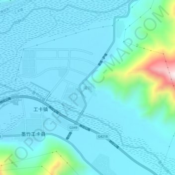
Name: 嘎则 topographic map, elevation, terrain.
Location: 嘎则, Lhasa, Tibet, China (29.82758 91.72416 29.86758 91.76416)
Average elevation: 12,740 ft
Minimum elevation: 12,484 ft
Maximum elevation: 14,593 ft
Thank you for supporting this site ❤️
Make a donation
Make a donation
Gear up for your next adventure:
As an Amazon Associate, this site earns from qualifying purchases at no extra cost to you.