
Thank you for supporting this site ❤️
Make a donation
Make a donation
Gear up for your next adventure:
As an Amazon Associate, this site earns from qualifying purchases at no extra cost to you.
Bühler topographic map
Click on the map to display elevation.
Thank you for supporting this site ❤️
Make a donation
Make a donation
Gear up for your next adventure:
As an Amazon Associate, this site earns from qualifying purchases at no extra cost to you.
About this map
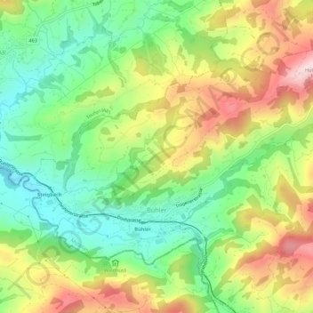
Name: Bühler topographic map, elevation, terrain.
Location: Bühler, Mittelland, Appenzell Rhodes-Extérieures, 9055, Suisse (47.36800 9.40032 47.39326 9.45434)
Average elevation: 3,051 ft
Minimum elevation: 2,572 ft
Maximum elevation: 3,714 ft
Thank you for supporting this site ❤️
Make a donation
Make a donation
Gear up for your next adventure:
As an Amazon Associate, this site earns from qualifying purchases at no extra cost to you.