Geolocate

Caraballo topographic map

Click on the map to display elevation.

About this map

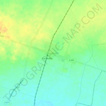
Name: Caraballo topographic map, elevation, terrain.

Location: Caraballo, Mayabeque, Cuba (23.03915 -81.93677 23.07915 -81.89677)

Average elevation: 361 ft

Minimum elevation: 318 ft

Maximum elevation: 413 ft

Gear up for your next adventure:

🔪Outdoor Multitools - Essential survival tools for gear repair and field use
🪑Ultralight Camp Chairs - Portable seating for resting after a long day of mapping
🌡️Portable Weather Meter - Track weather conditions on the trail
🗃️Trail First Aid Kit - Essential kit for outdoor injuries and emergencies
🧷Carabiner Set - Durable clips for gear attachment

As an Amazon Associate, this site earns from qualifying purchases at no extra cost to you.