Geolocate

San Rocco Castagnaretta topographic map

Click on the map to display elevation.

About this map

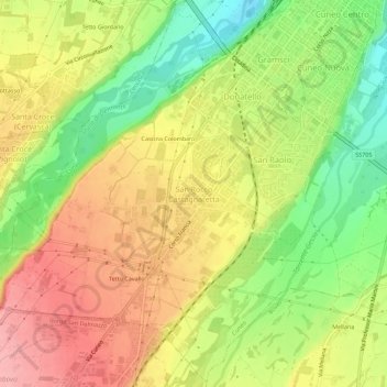
Name: San Rocco Castagnaretta topographic map, elevation, terrain.

Location: San Rocco Castagnaretta, Cuneo, Piedmont, 12100, Italy (44.34670 7.50225 44.38670 7.54225)

Average elevation: 1,867 ft

Minimum elevation: 1,654 ft

Maximum elevation: 2,057 ft

Gear up for your next adventure:

🥾Women's Hiking Boots - Top-rated trail boots with ankle support and superior grip
🧷Carabiner Set - Durable clips for gear attachment
🌧️Backpack Rain Cover - Keep gear dry in wet weather
🧥Waterproof Jacket for Hiking - Breathable and rugged rain jacket for outdoor excursions
📚Navigation Handbooks - Master the art of reading topographic maps and using a compass

As an Amazon Associate, this site earns from qualifying purchases at no extra cost to you.