Geolocate

Casadela topographic map

Click on the map to display elevation.

About this map

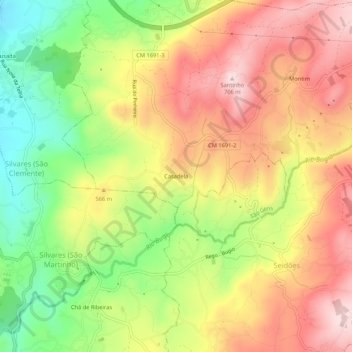
Name: Casadela topographic map, elevation, terrain.

Location: Casadela, Quinchães, Fafe, Braga, 4820-765, Portugal (41.39744 -8.15735 41.43744 -8.11735)

Average elevation: 1,703 ft

Minimum elevation: 1,060 ft

Maximum elevation: 2,283 ft

Gear up for your next adventure:

🛠️Outdoor Gear Repair Kit - Essential tools to fix gear on the trail
🕶️GPS Smartphone Mount - Secure mount for phone navigation
🪶LED Camping Lantern - Bright lantern for camp lighting
🧦Merino Wool Socks - Moisture-wicking, blister-preventing socks for long treks
🩳Quick‑Dry Hiking Shorts - Comfortable and quick‑dry shorts for summer hiking

As an Amazon Associate, this site earns from qualifying purchases at no extra cost to you.