Geolocate

Slawi topographic map

Click on the map to display elevation.

About this map

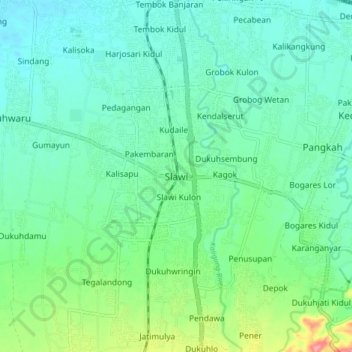
Name: Slawi topographic map, elevation, terrain.

Location: Slawi, Tegal, Central Java, Java, 52419, Indonesia (-7.02291 109.09637 -6.94291 109.17637)

Average elevation: 135 ft

Minimum elevation: 43 ft

Maximum elevation: 430 ft

Gear up for your next adventure:

🧴Hand Sanitizer - Keep hands clean while hiking
🧭Outdoor Navigation Book - Learn advanced navigation skills
📦Gear Storage Bags - Organize and protect outdoor equipment
🎒Day Hiking Backpack - Lightweight backpack perfect for day trips and outdoor adventures
🪶LED Camping Lantern - Bright lantern for camp lighting

As an Amazon Associate, this site earns from qualifying purchases at no extra cost to you.