Geolocate

Morgan topographic map

Click on the map to display elevation.

About this map

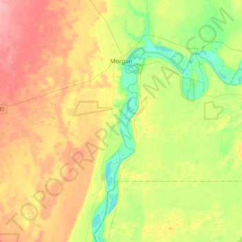
Name: Morgan topographic map, elevation, terrain.

Location: Morgan, Mid Murray Council, South Australia, 5320, Australia (-34.22176 139.55978 -33.97085 139.70265)

Average elevation: 138 ft

Minimum elevation: 0 ft

Maximum elevation: 299 ft

Other topographic maps

Click on a map to view its topography, its elevation and its terrain.

Black Hill

Australia > South Australia > Mid Murray Council > Truro

Average elevation: 1,220 ft

Gear up for your next adventure:

🌧️Backpack Rain Cover - Keep gear dry in wet weather
🧤Hiking Gloves - Protective gloves for rugged trails
🛏️Cold Weather Sleeping Bag - Warm sleeping bag for cold conditions
📖Nature Tracking Books - Learn to track wildlife and terrain
🌲Outdoor Survival Books - Best books on survival skills

As an Amazon Associate, this site earns from qualifying purchases at no extra cost to you.