Geolocate

Kumaon topographic map

Click on the map to display elevation.

About this map

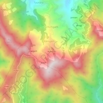
Name: Kumaon topographic map, elevation, terrain.

Location: Kumaon, Rāmgarh, Kosya Kutauli, Nainital, Uttarakhand, India (29.39830 79.53215 29.43830 79.57215)

Average elevation: 6,457 ft

Minimum elevation: 4,987 ft

Maximum elevation: 7,753 ft

Gear up for your next adventure:

🪶Thermal Camp Blanket - Extra warmth for cold nights
🪵Folding Camp Saw - Compact saw for wood and campsite work
😴Insulated Sleeping Pads - Compact and warm pads for high-elevation camping
🛡️Insect Repellent - Protection against bugs during outdoor activities
🌡️Portable Weather Meter - Track weather conditions on the trail

As an Amazon Associate, this site earns from qualifying purchases at no extra cost to you.