
Thank you for supporting this site ❤️
Make a donation
Make a donation
Gear up for your next adventure:
As an Amazon Associate, this site earns from qualifying purchases at no extra cost to you.
Rogassa topographic map
Click on the map to display elevation.
Thank you for supporting this site ❤️
Make a donation
Make a donation
Gear up for your next adventure:
As an Amazon Associate, this site earns from qualifying purchases at no extra cost to you.
About this map
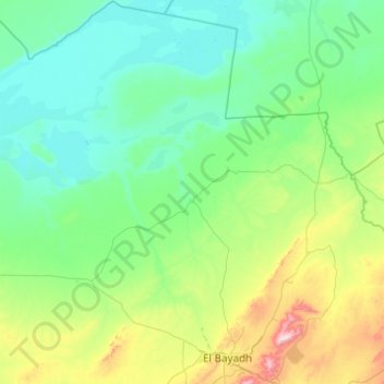
Name: Rogassa topographic map, elevation, terrain.
Location: Rogassa, Daïra Rogassa, El Bayadh, Algérie (33.62788 0.50837 34.44316 1.04311)
Average elevation: 3,737 ft
Minimum elevation: 3,212 ft
Maximum elevation: 6,578 ft
Thank you for supporting this site ❤️
Make a donation
Make a donation
Gear up for your next adventure:
As an Amazon Associate, this site earns from qualifying purchases at no extra cost to you.