Geolocate

Winters topographic map

Click on the map to display elevation.

About this map

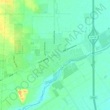
Name: Winters topographic map, elevation, terrain.

Location: Winters, Yolo County, California, 95694, United States (38.50491 -121.99080 38.54491 -121.95080)

Average elevation: 138 ft

Minimum elevation: 102 ft

Maximum elevation: 213 ft

Yolo County trails, hiking, mountain biking, running and outdoor activities

Gear up for your next adventure:

📚USA Hiking Guide Books - Top trail guides and map books
👖Convertible Hiking Pants - Versatile zip-off pants for changing altitudes and temperatures
🏥Hiking First Aid Kits - Comprehensive medical kits for remote trail injuries
🔋Solar Power Banks - Keep your GPS and phone charged in remote wilderness areas
🥾Men's Hiking Boots - Durable, waterproof footwear for rugged terrain and steep inclines

As an Amazon Associate, this site earns from qualifying purchases at no extra cost to you.