
Enka topographic map
Click on the map to display elevation.
About this map
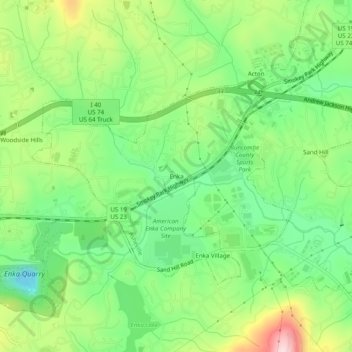
Name: Enka topographic map, elevation, terrain.
Average elevation: 2,169 ft
Minimum elevation: 1,785 ft
Maximum elevation: 2,805 ft
Buncombe County trails, hiking, mountain biking, running and outdoor activities
Other topographic maps
Click on a map to view its topography, its elevation and its terrain.
Beaver Lake
United States > North Carolina > Buncombe County > Asheville > Grace
Average elevation: 2,205 ft