
Thank you for supporting this site ❤️
Make a donation
Make a donation
Gear up for your next adventure:
As an Amazon Associate, this site earns from qualifying purchases at no extra cost to you.
Geier topographic map
Click on the map to display elevation.
Thank you for supporting this site ❤️
Make a donation
Make a donation
Gear up for your next adventure:
As an Amazon Associate, this site earns from qualifying purchases at no extra cost to you.
About this map
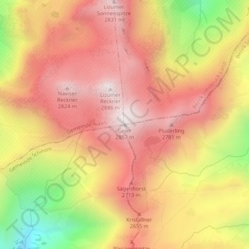
Name: Geier topographic map, elevation, terrain.
Location: Geier, Gemeinde Tux, Bezirk Schwaz, Tyrol, Austria (47.14007 11.63282 47.14017 11.63292)
Average elevation: 8,209 ft
Minimum elevation: 6,381 ft
Maximum elevation: 9,341 ft
Thank you for supporting this site ❤️
Make a donation
Make a donation
Gear up for your next adventure:
As an Amazon Associate, this site earns from qualifying purchases at no extra cost to you.