
Thank you for supporting this site ❤️
Make a donation
Make a donation
Gear up for your next adventure:
As an Amazon Associate, this site earns from qualifying purchases at no extra cost to you.
Hyder topographic map
Click on the map to display elevation.
Thank you for supporting this site ❤️
Make a donation
Make a donation
Gear up for your next adventure:
As an Amazon Associate, this site earns from qualifying purchases at no extra cost to you.
About this map
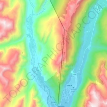
Name: Hyder topographic map, elevation, terrain.
Location: Hyder, Unorganized Borough, Alaska, 99923, United States (55.91120 -130.07683 56.04406 -130.00349)
Average elevation: 2,270 ft
Minimum elevation: -23 ft
Maximum elevation: 6,411 ft
Unorganized Borough trails, hiking, mountain biking, running and outdoor activities
Thank you for supporting this site ❤️
Make a donation
Make a donation
Gear up for your next adventure:
As an Amazon Associate, this site earns from qualifying purchases at no extra cost to you.