Geolocate

Hyder topographic map

Click on the map to display elevation.

About this map

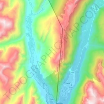
Name: Hyder topographic map, elevation, terrain.

Location: Hyder, Unorganized Borough, Alaska, 99923, United States (55.91120 -130.07683 56.04406 -130.00349)

Average elevation: 2,270 ft

Minimum elevation: -23 ft

Maximum elevation: 6,411 ft

Unorganized Borough trails, hiking, mountain biking, running and outdoor activities

Gear up for your next adventure:

🔊Portable Camp Speaker - Music and alerts at camp
🔦Compact Flashlight - Reliable flashlight for emergencies
🧭Pro Hiking Compasses - High-accuracy liquid-filled compasses for topographic orientation
🪶Multi‑Purpose Knife - Useful blade for camp and trail
📡Handheld GPS Device - Reliable handheld GPS for outdoor navigation

As an Amazon Associate, this site earns from qualifying purchases at no extra cost to you.