
Manahari topographic map
Interactive map
Click on the map to display elevation.
About this map
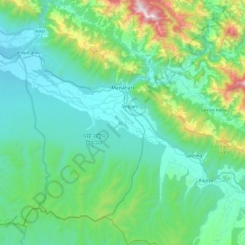
Name: Manahari topographic map, elevation, terrain.
Location: Manahari, Makwanpur, Bagmati Pradesh, Nepal (27.41620 84.71349 27.60969 84.89827)
Average elevation: 1,729 ft
Minimum elevation: 758 ft
Maximum elevation: 5,358 ft