Geolocate

Lordelo topographic map

Click on the map to display elevation.

About this map

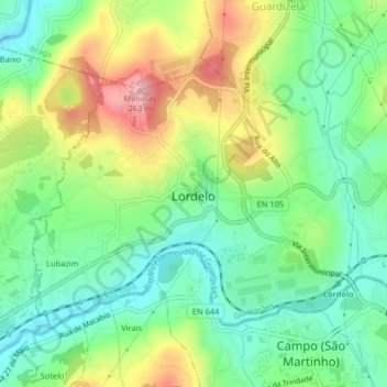
Name: Lordelo topographic map, elevation, terrain.

Location: Lordelo, Guimarães, Braga, 4815-182, Portugal (41.36199 -8.39564 41.38344 -8.35504)

Average elevation: 469 ft

Minimum elevation: 249 ft

Maximum elevation: 837 ft

Other topographic maps

Click on a map to view its topography, its elevation and its terrain.

Guimarães

Portugal > Braga > Guimarães

Average elevation: 981 ft

Além

Portugal > Braga > Guimarães > Sande (Vila Nova)

Average elevation: 472 ft

Gear up for your next adventure:

👟Men's Trail Runners - Lightweight footwear for fast-paced exploration and light hiking
🪶Wildlife Field Guides - Learn animal tracking and species ID
🧢Outdoor Hiking Hat - Sun protection hat for outdoor explorers
🥘Titanium Cookware - Durable, featherlight pots and pans for backpacking
🪑Ultralight Camp Chairs - Portable seating for resting after a long day of mapping

As an Amazon Associate, this site earns from qualifying purchases at no extra cost to you.