Geolocate

Lasco topographic map

Click on the map to display elevation.

👉 Easily get elevation data in JSON, GeoTIFF and KML formats using Elevation API
Thank you for supporting this site ❤️
Make a donation

About this map

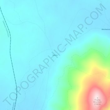
Name: Lasco topographic map, elevation, terrain.

Location: Lasco, Lassen County, California, United States (40.40239 -120.99274 40.44239 -120.95274)

Average elevation: 5,758 ft

Minimum elevation: 5,512 ft

Maximum elevation: 7,060 ft

Lassen County trails, hiking, mountain biking, running and outdoor activities

Gear up for your next adventure:

🥤Water Filter Bottle - All‑in‑one filter bottle for safe hydration
🎒Outdoor Daypacks - Lightweight backpacks designed for carrying maps and essential gear
🗺️NatGeo Topo Maps - High-quality waterproof printed topographic maps of US Parks
🛠️Outdoor Gear Repair Kit - Essential tools to fix gear on the trail
🚪Portable Camp Chair - Foldable chair for comfort at camp

As an Amazon Associate, this site earns from qualifying purchases at no extra cost to you.