
Alakode topographic map
Click on the map to display elevation.
About this map
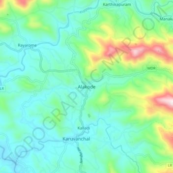
Name: Alakode topographic map, elevation, terrain.
Location: Alakode, Taliparamba, Kannur, Kerala, 670571, India (12.15156 75.42714 12.23156 75.50714)
Average elevation: 548 ft
Minimum elevation: 43 ft
Maximum elevation: 2,228 ft
Other topographic maps
Click on a map to view its topography, its elevation and its terrain.