Geolocate

Mutha topographic map

Click on the map to display elevation.

About this map

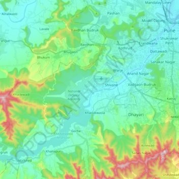
Name: Mutha topographic map, elevation, terrain.

Location: Mutha, Sangrun, Haveli, Pune District, Maharashtra, India (18.39285 73.67209 18.53157 73.86075)

Average elevation: 2,201 ft

Minimum elevation: 1,765 ft

Maximum elevation: 3,747 ft

Gear up for your next adventure:

🖼️Topo Map Wall Art - Decorative topographic prints of famous peaks and regions
🌡️Handheld Weather Meters - Measure wind, temp, and pressure for safe mountain travel
🥾Men's Hiking Boots - Durable, waterproof footwear for rugged terrain and steep inclines
Backpacking Tents - Weight-optimized shelters for multi-day topographic surveys
🎒Hydration Pack - Hands‑free water reservoir for long hikes

As an Amazon Associate, this site earns from qualifying purchases at no extra cost to you.