
Thank you for supporting this site ❤️
Make a donation
Make a donation
Gear up for your next adventure:
As an Amazon Associate, this site earns from qualifying purchases at no extra cost to you.
Gohimont topographic map
Click on the map to display elevation.
Thank you for supporting this site ❤️
Make a donation
Make a donation
Gear up for your next adventure:
As an Amazon Associate, this site earns from qualifying purchases at no extra cost to you.
About this map
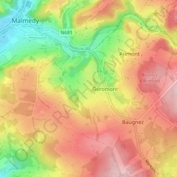
Name: Gohimont topographic map, elevation, terrain.
Location: Gohimont, Malmedy, Verviers, Liège, Wallonie, 4960, Belgique (50.39114 6.03007 50.43114 6.07007)
Average elevation: 1,483 ft
Minimum elevation: 1,076 ft
Maximum elevation: 1,814 ft
Thank you for supporting this site ❤️
Make a donation
Make a donation
Gear up for your next adventure:
As an Amazon Associate, this site earns from qualifying purchases at no extra cost to you.