
Thank you for supporting this site ❤️
Make a donation
Make a donation
Gear up for your next adventure:
As an Amazon Associate, this site earns from qualifying purchases at no extra cost to you.
Megoda topographic map
Click on the map to display elevation.
Thank you for supporting this site ❤️
Make a donation
Make a donation
Gear up for your next adventure:
As an Amazon Associate, this site earns from qualifying purchases at no extra cost to you.
About this map
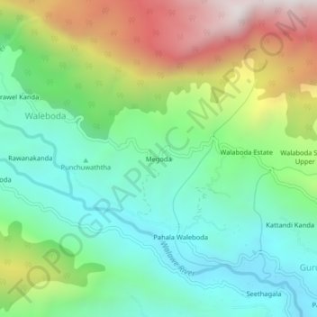
Name: Megoda topographic map, elevation, terrain.
Location: Megoda, Ratnapura District, Sabaragamuwa Province, Sri Lanka (6.70696 80.60773 6.74696 80.64773)
Average elevation: 3,091 ft
Minimum elevation: 1,729 ft
Maximum elevation: 5,696 ft
Thank you for supporting this site ❤️
Make a donation
Make a donation
Gear up for your next adventure:
As an Amazon Associate, this site earns from qualifying purchases at no extra cost to you.