Geolocate

Lawley topographic map

Click on the map to display elevation.

About this map

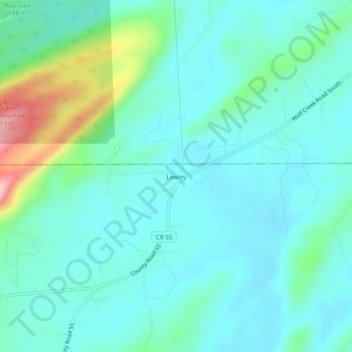
Name: Lawley topographic map, elevation, terrain.

Location: Lawley, Shelby County, Alabama, United States (33.48122 -86.46748 33.52122 -86.42748)

Average elevation: 551 ft

Minimum elevation: 423 ft

Maximum elevation: 1,060 ft

Shelby County trails, hiking, mountain biking, running and outdoor activities

Gear up for your next adventure:

🪑Ultralight Camp Chairs - Portable seating for resting after a long day of mapping
🥄Camping Utensil Set - Lightweight utensils for outdoor meals
🥇GPS Hiking Watch - Multi‑sport GPS watch with navigation and trail tracking
🏕️Tent Footprint - Protect your tent base from wear
🧴Hand Sanitizer - Keep hands clean while hiking

As an Amazon Associate, this site earns from qualifying purchases at no extra cost to you.