Geolocate

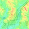
Lanham topographic map

Click on the map to display elevation.

About this map

Name: Lanham topographic map, elevation, terrain.

Location: Lanham, Jones County, Mississippi, United States (31.56322 -89.11700 31.60322 -89.07700)

Average elevation: 207 ft

Minimum elevation: 161 ft

Maximum elevation: 289 ft

Other topographic maps

Click on a map to view its topography, its elevation and its terrain.
Laurel

United States > Mississippi > Jones County

Average elevation: 253 ft

Ellisville

United States > Mississippi > Jones County

Average elevation: 230 ft

Ellisville

United States > Mississippi > Jones County

Average elevation: 230 ft

Laurel

United States > Mississippi > Jones County

Average elevation: 253 ft

Gear up for your next adventure:

📖Nature Tracking Books - Learn to track wildlife and terrain
🧤Tactile Hiking Gloves - Keep hands warm while operating GPS and smartphone screens
🧯Emergency Survival Kit - All‑in‑one survival essentials for the backcountry
🧢Sun Protection Hats - Wide-brimmed and UPF-rated hats for high-altitude sun safety
🍳Camping Cook Set - Complete cookware for outdoor meals

As an Amazon Associate, this site earns from qualifying purchases at no extra cost to you.