Geolocate

Chigwell topographic map

Click on the map to display elevation.

About this map

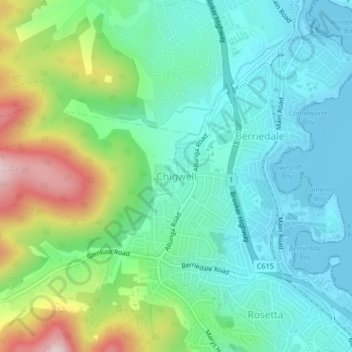
Name: Chigwell topographic map, elevation, terrain.

Location: Chigwell, Hobart, City of Glenorchy, Tasmania, Australia (-42.81502 147.20892 -42.79962 147.25071)

Average elevation: 322 ft

Minimum elevation: -7 ft

Maximum elevation: 1,152 ft

Other topographic maps

Click on a map to view its topography, its elevation and its terrain.

Selfs Point

Australia > Tasmania > Hobart

Average elevation: 56 ft

Waterworks Reserve

Australia > Tasmania > Hobart

Average elevation: 787 ft

James Austin Park

Australia > Tasmania > Hobart

Average elevation: 82 ft

Perrins Ridge

Australia > Tasmania > Hobart

Average elevation: 1,532 ft

Cartwright Point

Australia > Tasmania > Hobart

Average elevation: 194 ft

Mount Direction

Australia > Tasmania > Hobart

Average elevation: 545 ft

Glebe Hill

Australia > Tasmania > Hobart

Average elevation: 217 ft

Knocklofty

Australia > Tasmania > Hobart

Average elevation: 607 ft

Snug Falls

Australia > Tasmania > Hobart > Snug

Average elevation: 1,102 ft

Tolosa Park

Australia > Tasmania > Hobart

Average elevation: 597 ft

Glenrose Park

Australia > Tasmania > Hobart

Average elevation: 594 ft

Gear up for your next adventure:

🔥Camping Stove - Portable stove for camping and backcountry cooking
🏕️Tent Footprint - Protect your tent base from wear
🛰️Handheld GPS Units - Professional satellite navigators for precise backcountry mapping
🔦Powerful Headlamps - Ultra-bright hands-free lighting for night navigation
🥄Camping Utensil Set - Lightweight utensils for outdoor meals

As an Amazon Associate, this site earns from qualifying purchases at no extra cost to you.