Geolocate

Chontabamba topographic map

Click on the map to display elevation.

About this map

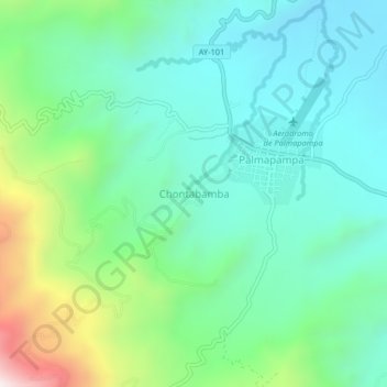
Name: Chontabamba topographic map, elevation, terrain.

Location: Chontabamba, Samugari, La Mar, Ayacucho, Perú (-12.79197 -73.68446 -12.75197 -73.64446)

Average elevation: 2,966 ft

Minimum elevation: 2,119 ft

Maximum elevation: 5,417 ft

Gear up for your next adventure:

👟Trail Running Shoes - Lightweight shoes for trail runners
🪑Portable Camp Table - Compact table for campsite meals
📱Solar Portable Charger - Solar power bank for charging devices off‑grid
🪶Multi‑Purpose Knife - Useful blade for camp and trail
📶Satellite Messenger - Communication device off‑grid

As an Amazon Associate, this site earns from qualifying purchases at no extra cost to you.