Geolocate

Monreal topographic map

Click on the map to display elevation.

About this map

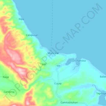
Name: Monreal topographic map, elevation, terrain.

Location: Monreal, Masbate, Bicol Region, Philippines (12.60414 123.62378 12.68414 123.70378)

Average elevation: 203 ft

Minimum elevation: -3 ft

Maximum elevation: 1,033 ft

Gear up for your next adventure:

📖Nature Tracking Books - Learn to track wildlife and terrain
🧣Hiking Neck Gaiter - Multi‑use neck protection for outdoor weather
🥇GPS Hiking Watch - Multi‑sport GPS watch with navigation and trail tracking
🧣Merino Neck Gaiters - Multi-functional headwear for wind and sun protection
🩳Quick‑Dry Hiking Shorts - Comfortable and quick‑dry shorts for summer hiking

As an Amazon Associate, this site earns from qualifying purchases at no extra cost to you.