
Thank you for supporting this site ❤️
Make a donation
Make a donation
Gear up for your next adventure:
As an Amazon Associate, this site earns from qualifying purchases at no extra cost to you.
Boțani topographic map
Click on the map to display elevation.
Thank you for supporting this site ❤️
Make a donation
Make a donation
Gear up for your next adventure:
As an Amazon Associate, this site earns from qualifying purchases at no extra cost to you.
About this map
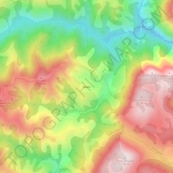
Name: Boțani topographic map, elevation, terrain.
Location: Boțani, Dealu Geoagiului, Întregalde, Alba, 517591, Romania (46.26582 23.41654 46.30582 23.45654)
Average elevation: 2,841 ft
Minimum elevation: 1,834 ft
Maximum elevation: 3,855 ft
Thank you for supporting this site ❤️
Make a donation
Make a donation
Gear up for your next adventure:
As an Amazon Associate, this site earns from qualifying purchases at no extra cost to you.