
Kokomo topographic map
Click on the map to display elevation.
About this map
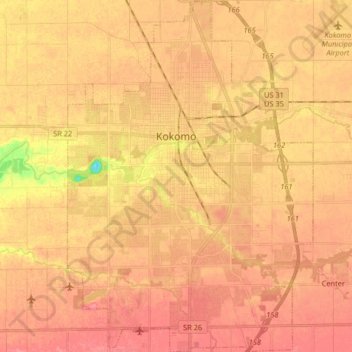
Name: Kokomo topographic map, elevation, terrain.
Location: Kokomo, Howard County, Indiana, United States (40.41027 -86.18426 40.53460 -86.06991)
Average elevation: 833 ft
Minimum elevation: 676 ft
Maximum elevation: 896 ft
Howard County trails, hiking, mountain biking, running and outdoor activities
Other topographic maps
Click on a map to view its topography, its elevation and its terrain.