Geolocate

Langenroda topographic map

Click on the map to display elevation.

About this map

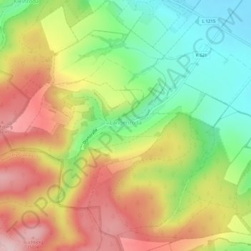
Name: Langenroda topographic map, elevation, terrain.

Location: Langenroda, Wiehe, Roßleben-Wiehe, Kyffhäuserkreis, Thuringia, Germany (51.26692 11.34040 51.28730 11.38996)

Average elevation: 774 ft

Minimum elevation: 387 ft

Maximum elevation: 1,188 ft

Other topographic maps

Click on a map to view its topography, its elevation and its terrain.

Wörl

Germany > Thuringia > Kyffhäuserkreis

Average elevation: 397 ft

Gear up for your next adventure:

🗻Climbing Gear Basics - Essential gear for beginner climbers
📷Action Camera - Capture your outdoor adventures in HD
📡GPS Antenna Upgrade - Enhance GPS reception in remote terrain
🗺️Topographic Maps - Detailed topo maps for hiking, exploring and outdoor navigation
🌎3D Topographic Globes - Raised relief globes for a tactile understanding of geography

As an Amazon Associate, this site earns from qualifying purchases at no extra cost to you.