
Thank you for supporting this site ❤️
Make a donation
Make a donation
Gear up for your next adventure:
As an Amazon Associate, this site earns from qualifying purchases at no extra cost to you.
Promano topographic map
Click on the map to display elevation.
Thank you for supporting this site ❤️
Make a donation
Make a donation
Gear up for your next adventure:
As an Amazon Associate, this site earns from qualifying purchases at no extra cost to you.
About this map
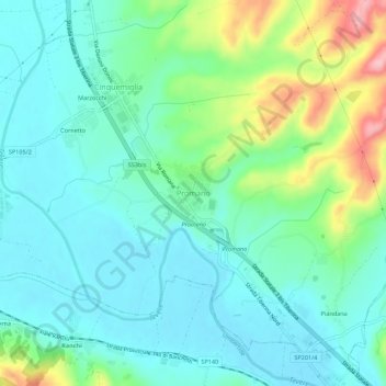
Name: Promano topographic map, elevation, terrain.
Location: Promano, Città di Castello, Perugia, Umbria, 06018, Italia (43.34736 12.24814 43.38736 12.28814)
Average elevation: 945 ft
Minimum elevation: 814 ft
Maximum elevation: 1,335 ft
Thank you for supporting this site ❤️
Make a donation
Make a donation
Gear up for your next adventure:
As an Amazon Associate, this site earns from qualifying purchases at no extra cost to you.