
Thank you for supporting this site ❤️
Make a donation
Make a donation
Gear up for your next adventure:
As an Amazon Associate, this site earns from qualifying purchases at no extra cost to you.
Pairo topographic map
Click on the map to display elevation.
Thank you for supporting this site ❤️
Make a donation
Make a donation
Gear up for your next adventure:
As an Amazon Associate, this site earns from qualifying purchases at no extra cost to you.
About this map
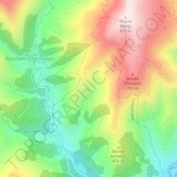
Name: Pairo topographic map, elevation, terrain.
Location: Pairo, Dolceacqua, Provincia di Imperia, Liguria, 18035, Italia (43.87607 7.60250 43.89607 7.62250)
Average elevation: 1,319 ft
Minimum elevation: 262 ft
Maximum elevation: 2,628 ft
Thank you for supporting this site ❤️
Make a donation
Make a donation
Gear up for your next adventure:
As an Amazon Associate, this site earns from qualifying purchases at no extra cost to you.