
Thank you for supporting this site ❤️
Make a donation
Make a donation
Gear up for your next adventure:
As an Amazon Associate, this site earns from qualifying purchases at no extra cost to you.
Madinat al Haqq topographic map
Click on the map to display elevation.
Thank you for supporting this site ❤️
Make a donation
Make a donation
Gear up for your next adventure:
As an Amazon Associate, this site earns from qualifying purchases at no extra cost to you.
About this map
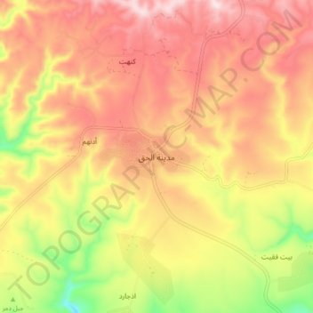
Name: Madinat al Haqq topographic map, elevation, terrain.
Location: Madinat al Haqq, Dhofar Governorate, Oman (17.13552 54.34784 17.21552 54.42784)
Average elevation: 2,385 ft
Minimum elevation: 1,516 ft
Maximum elevation: 3,005 ft
Thank you for supporting this site ❤️
Make a donation
Make a donation
Gear up for your next adventure:
As an Amazon Associate, this site earns from qualifying purchases at no extra cost to you.