Geolocate

Rule topographic map

Click on the map to display elevation.

About this map

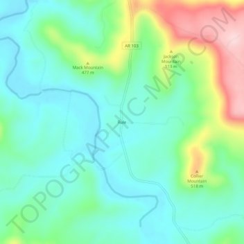
Name: Rule topographic map, elevation, terrain.

Location: Rule, Carroll County, Arkansas, United States (36.25785 -93.47991 36.29785 -93.43991)

Average elevation: 1,417 ft

Minimum elevation: 1,181 ft

Maximum elevation: 2,028 ft

Carroll County trails, hiking, mountain biking, running and outdoor activities

Other topographic maps

Click on a map to view its topography, its elevation and its terrain.

Blue Eye, AR

United States > Arkansas > Carroll County

Average elevation: 1,250 ft

Gear up for your next adventure:

🔥Camping Stove - Portable stove for camping and backcountry cooking
🪶Compact Camp Shovel - Folding shovel for campsite tasks
🔋Solar Power Banks - Keep your GPS and phone charged in remote wilderness areas
🔪Outdoor Multitools - Essential survival tools for gear repair and field use
🪑Portable Camp Table - Compact table for campsite meals

As an Amazon Associate, this site earns from qualifying purchases at no extra cost to you.