Geolocate

Rohnert Park topographic map

Click on the map to display elevation.

About this map

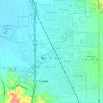
Name: Rohnert Park topographic map, elevation, terrain.

Location: Rohnert Park, Sonoma County, California, USA (38.31429 -122.73212 38.37252 -122.66699)

Average elevation: 128 ft

Minimum elevation: 82 ft

Maximum elevation: 420 ft

Gear up for your next adventure:

🎒Day Hiking Backpack - Lightweight backpack perfect for day trips and outdoor adventures
🧷Carabiner Set - Durable clips for gear attachment
☀️Outdoor Sunscreen - High protection sunscreen for outdoor activities
📦Gear Storage Bags - Organize and protect outdoor equipment
🌐World Map Poster - Decorative world maps with topographic info

As an Amazon Associate, this site earns from qualifying purchases at no extra cost to you.