
Thank you for supporting this site ❤️
Make a donation
Make a donation
Gear up for your next adventure:
As an Amazon Associate, this site earns from qualifying purchases at no extra cost to you.
Qianxinan topographic map
Click on the map to display elevation.
Thank you for supporting this site ❤️
Make a donation
Make a donation
Gear up for your next adventure:
As an Amazon Associate, this site earns from qualifying purchases at no extra cost to you.
About this map
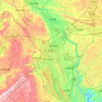
Name: Qianxinan topographic map, elevation, terrain.
Location: Qianxinan, Xingyi, Guizhou, China (24.09254 103.90192 26.09254 105.90192)
Average elevation: 4,613 ft
Minimum elevation: 1,014 ft
Maximum elevation: 8,848 ft
Thank you for supporting this site ❤️
Make a donation
Make a donation
Gear up for your next adventure:
As an Amazon Associate, this site earns from qualifying purchases at no extra cost to you.