Denizli topographic map
Click on the map to display elevation.
Denizli
Denizli has a Mediterranean climate (Köppen: Csa or Trewartha: Cs), with hot, dry summers and mild to cool, rainy winters. The inland areas, like Çardak, Bozkurt, Çivril, and Çal districts/counties of the province are cooler and have a higher elevation than the seaside, western part of the Province. Therefore, there are climatic differences within the province and even in the Denizli urbanized area. The land is open to winds coming from the Aegean Sea as the mountains are perpendicular to the coastline.
About this map
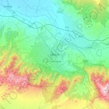
Name: Denizli topographic map, elevation, terrain.
Location: Denizli, Pamukkale, Denizli, Aegean Region, 20175, Turkey (37.62279 28.93665 37.94279 29.25665)
Average elevation: 2,438 ft
Minimum elevation: 459 ft
Maximum elevation: 8,274 ft
Other topographic maps
Click on a map to view its topography, its elevation and its terrain.