Geolocate

Topping topographic map

Click on the map to display elevation.

About this map

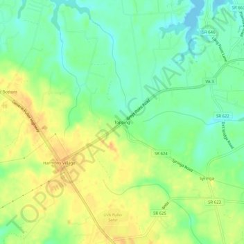
Name: Topping topographic map, elevation, terrain.

Location: Topping, Middlesex County, Virginia, 23169, United States (37.56819 -76.49439 37.60819 -76.45439)

Average elevation: 52 ft

Minimum elevation: -10 ft

Maximum elevation: 108 ft

Middlesex County trails, hiking, mountain biking, running and outdoor activities

Other topographic maps

Click on a map to view its topography, its elevation and its terrain.

Urbanna

United States > Virginia > Middlesex County

Average elevation: 26 ft

Gear up for your next adventure:

🌡️Portable Weather Meter - Track weather conditions on the trail
🔥Camping Stove - Portable stove for camping and backcountry cooking
🎒Hydration Pack - Hands‑free water reservoir for long hikes
💧Water Filtration Bottles - Safely drink from streams and lakes while exploring
🖼️Topo Map Wall Art - Decorative topographic prints of famous peaks and regions

As an Amazon Associate, this site earns from qualifying purchases at no extra cost to you.